Weather guide
Nowcast vs. radar vs. hourly forecast: what is the difference?
Radar shows recent precipitation, nowcasting projects the immediate future, and an hourly model forecast looks farther ahead. Use each for the question it can answer.
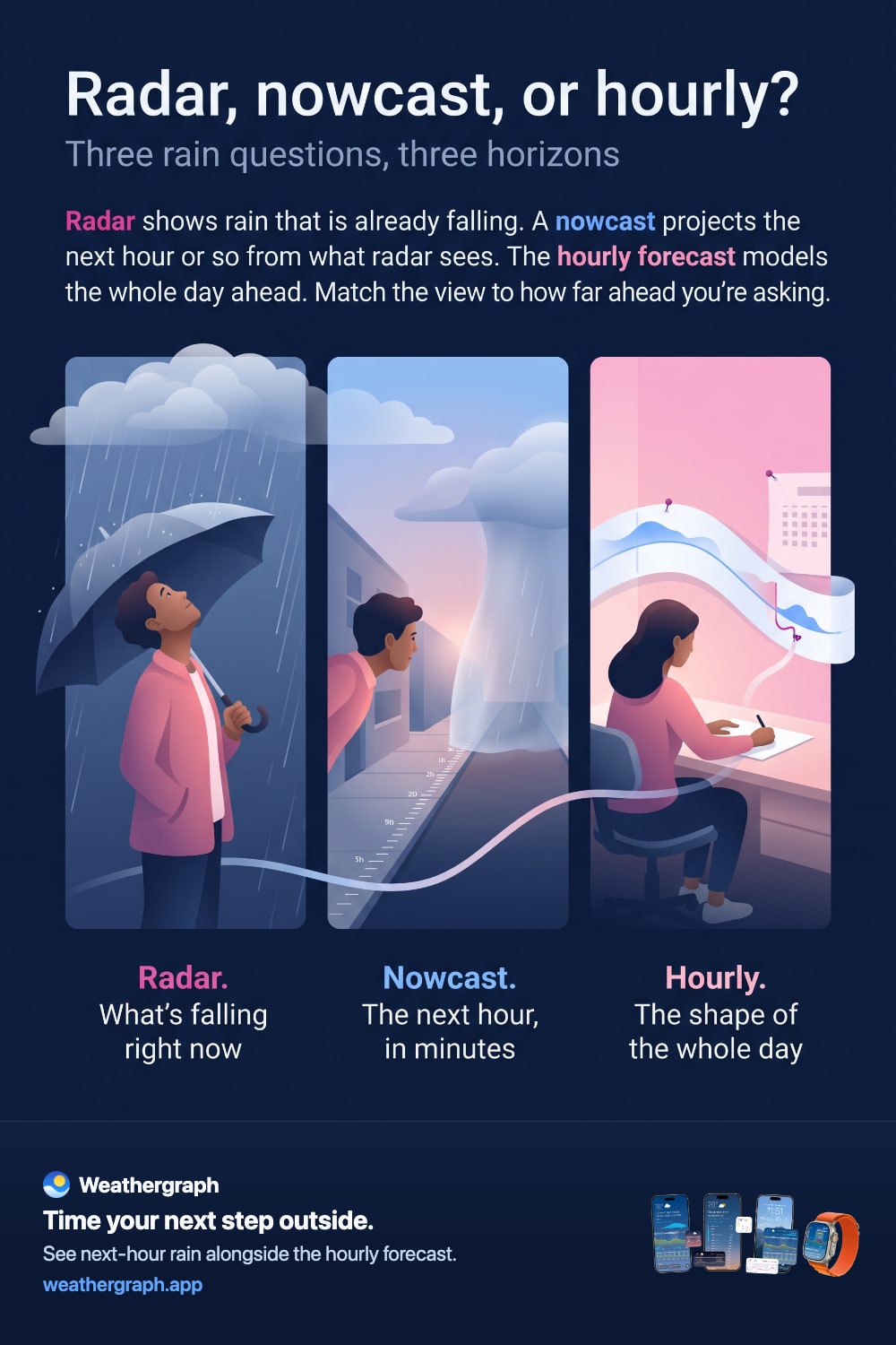
Radar, nowcast, and hourly forecast are related, but they answer different questions. Radar helps show where precipitation has recently been detected. A nowcast estimates what is likely to happen in the immediate future. An hourly forecast uses numerical weather prediction to look farther ahead.
The quick answer, and where each one lives in Weathergraph
The three views answer three different time horizons, and most apps separate them across different screens. Weathergraph stacks them in one scroll, so the horizon you need is the one you are already looking at:
- Radar — "where is the rain right now?" A map of recent precipitation and how it has moved. An observation of the last few minutes, not a forecast.
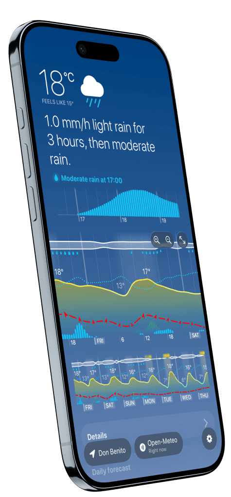
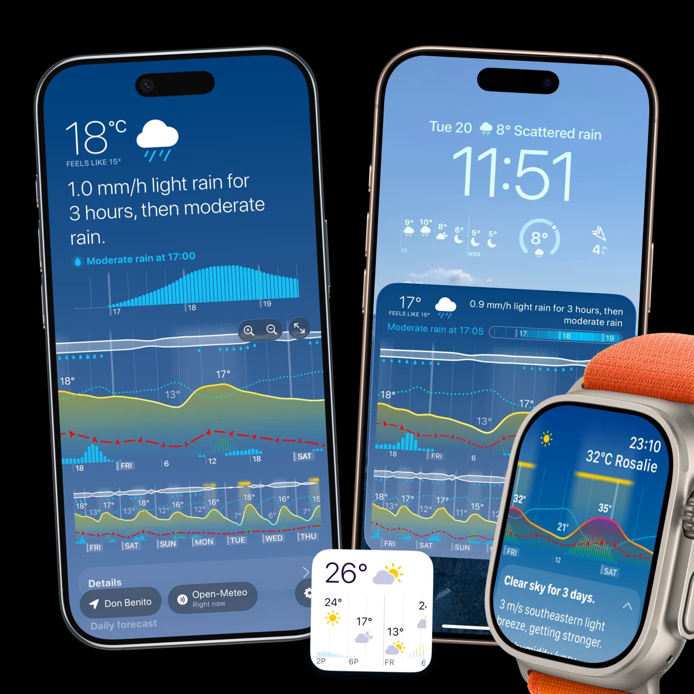
- Nowcast — "will it reach me in the next few hours?" In Weathergraph this is the minute-by-minute bar graph directly under the current conditions, covering the next three hours, with a label naming the intensity in mm/h. Bar height is the rain rate, so you can see the shower start, peak and taper. This is the view that answers "do I have twenty minutes to walk the dog".
- Hourly forecast — "what does the rest of the day look like?" The main chart below it, about a day and a half at a time and scrollable further, with rain shown as amount and probability alongside temperature, wind and cloud.
The practical rule: the shorter the horizon, the more you should trust the observation; the longer the horizon, the more you are reading a model. A nowcast is extrapolation from what is already in the sky, so it is sharp for an hour and vague by hour four. An hourly model forecast is the opposite — weaker on the exact minute, far better on the shape of tomorrow.
Which one should you check?
| Tool | Best question | Typical strength | Important limit |
|---|---|---|---|
| Radar image or animation | “Where has precipitation been detected, and how has it moved?” | Recent spatial observation and storm structure | Radar measures returned energy aloft; it is not a direct promise of rain reaching your exact ground location. |
| Precipitation nowcast | “Is rain or snow likely to reach me soon?” | Detailed very-short-range timing derived from recent data and motion | Fast growth, decay, terrain, gaps in radar coverage, and changing storm motion can defeat extrapolation. |
| Hourly model forecast | “What is the broader plan for later today or the next several days?” | Longer horizon and many weather variables | Timing and local detail become less certain, especially farther ahead. |
The Met Office describes nowcasting as mapping current weather and estimating its short-term movement; the World Meteorological Organization definition it cites extends from the present to six hours ahead. Read the Met Office overview.
Radar is an observation—with caveats
Weather radar sends pulses and measures energy reflected back from precipitation and other targets. That makes it a powerful view of recent conditions, but radar can detect non-weather objects, overshoot shallow precipitation far from the instrument, or see precipitation in a cloud that does not reach the ground.
The US National Weather Service explains that reflectivity represents returned energy and that radar interpretation has range and target limitations. See its radar guide.
A radar animation adds motion by showing several recent scans. Extending that motion forward is already a forecast: a nowcast.
A nowcast is a very short forecast
A precipitation nowcast begins with recent observations—often radar—and estimates the next part of the storm's path and intensity. Some systems also use satellite observations, numerical models, machine learning, or surface measurements.
Nowcasting is particularly useful for immediate questions such as whether to delay departure, bring rain protection, or finish an outdoor task first. It is less suited to deciding what next weekend will look like.
Because storms can form, split, strengthen, weaken, or change direction, a precise minute remains an estimate. Read “rain in 30 minutes” as actionable short-range guidance, not a guarantee that the first drop arrives at exactly that minute.
An hourly forecast provides the wider plan
Numerical models simulate the atmosphere beyond the very-short-range window and include temperature, cloud, wind, pressure, and other variables. The hourly forecast lets you see the expected sequence of the day even where radar coverage is limited or before a storm exists to observe.
When the nowcast and hourly forecast disagree, their different inputs and horizons are often the reason. Close to the event, the nowcast may respond to a rain area that the earlier model run misplaced. The nowcast can also extrapolate a shower that later dissipates. Keep both horizons visible and update the decision as the event approaches.
Rain probability and rain amount answer different questions
Probability of precipitation is the chance that measurable precipitation occurs at a location during a stated period. It does not say how long it will rain or how much will fall. See the National Weather Service definition.
- Probability: How likely is measurable precipitation here in this period?
- Amount or rate: How much precipitation, or how intense, is forecast?
- Nowcast timing: If detected or predicted soon, when might it begin and how may it move?
A high probability with small bars may mean likely but light precipitation. A lower probability with larger bars may describe a less certain but potentially wetter outcome. The graph needs both signals.
What Weathergraph does—and does not do
With Weathergraph Pro, the app checks short-range nowcast data approximately every hour. When rain, sleet, or snow is detected in the forecast window ahead, Weathergraph can show the expected start time and precipitation type in its widget and provide rain or snow alerts. If no specific precipitation is detected but forecast probability reaches the documented threshold, the app shows the chance instead.
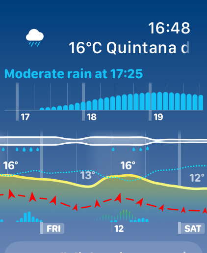
Weathergraph does not currently provide a full interactive radar map. It presents the nowcast as a decision signal alongside the hourly graph and can link to local radar services. If your job is inspecting storm cells spatially, use a dedicated radar or official weather service alongside Weathergraph.
Weathergraph also does not currently display governmental weather alerts. For thunderstorms, floods, extreme heat, wildfire weather, marine hazards, aviation, or any safety-critical situation, consult the responsible official service and follow its warnings.
Sources and limits
- The Met Office nowcasting overview explains the short forecast horizon and the use of radar-based tracking.
- The National Weather Service radar guide explains how Doppler radar obtains precipitation information from returned energy.
- The NWS probability-of-precipitation definition distinguishes likelihood from amount and duration.
- Weathergraph behavior and current product limitations are documented in the Weathergraph FAQ.
Weathergraph
See approaching rain in the context of your day
Weathergraph places short-range precipitation timing beside the longer hourly forecast, so an approaching shower makes sense alongside temperature, wind, and the plans it may interrupt.
