Weather guide
Why clear, calm nights so often end in fog
Fog is a cloud that forms where it stands. On a clear, still night the ground radiates heat to space, the air just above it cools to its dew point, and the moisture it was holding condenses in place.
Updated August 11, 2026
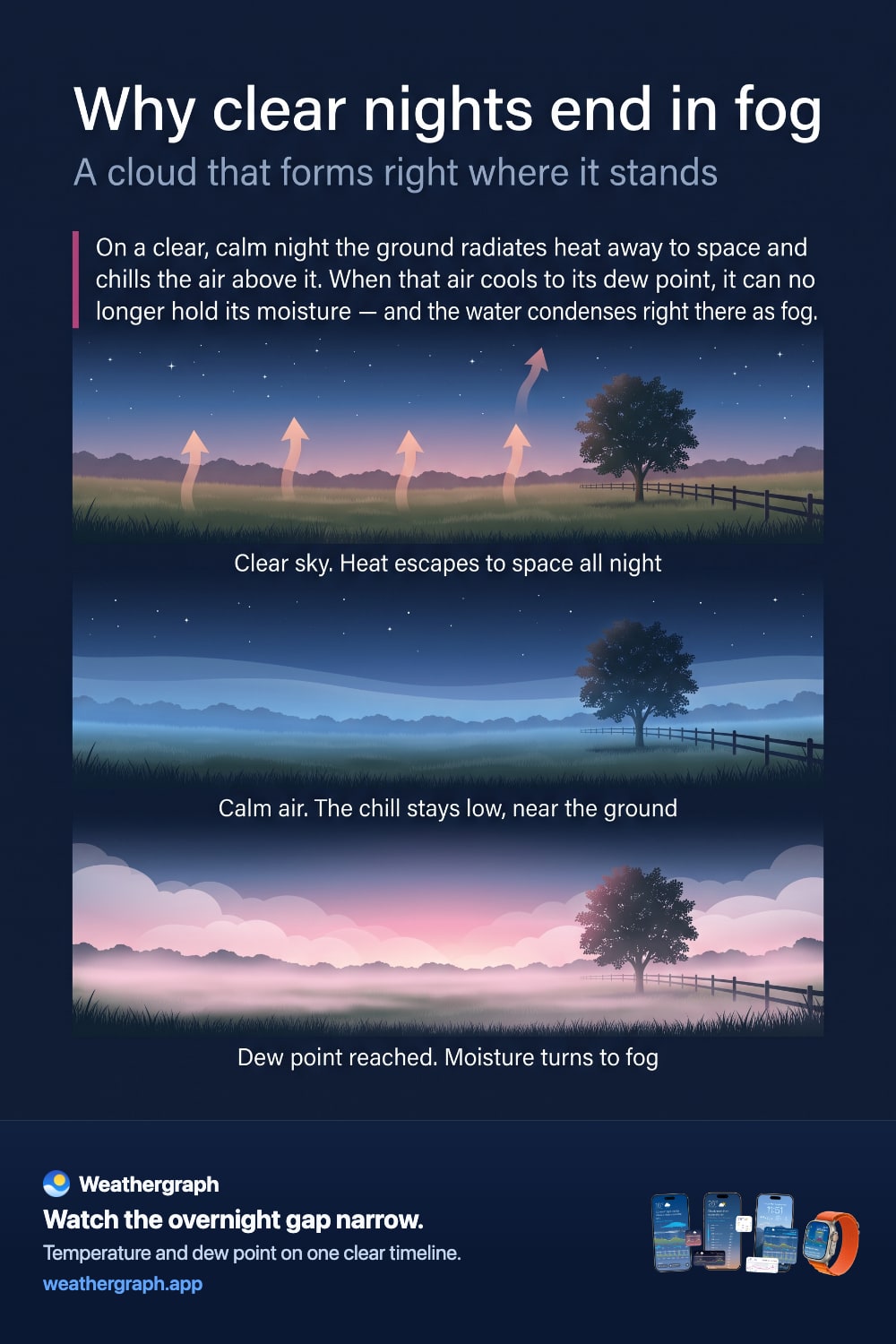
The clearest, stillest evenings are the ones most likely to hand you a foggy morning. That sounds backwards—surely clouds and wind bring fog?—but the mechanism is straightforward once you see what a clear, calm night actually does to the air near the ground.
The short answer
- The ground loses heat to space all night. With no cloud layer to send that heat back down, the surface cools quickly.
- The air just above the ground cools with it. Calm conditions mean that chilled layer stays put instead of mixing with warmer air higher up.
- When air cools to its dew point, it can hold no more moisture. The water vapour it was carrying condenses into droplets.
- Those droplets are fog. It is a cloud, formed at ground level, out of moisture that was already there.
This is what meteorologists call radiation fog. The US National Weather Service defines it as fog that forms "when outgoing longwave radiation cools the near-surface air below its dew point temperature." See the NWS glossary entry.
Why clear skies matter
Everything warmer than absolute zero radiates heat, and the ground is no exception. During the day it gains more energy from the sun than it loses. After sunset the gain stops and the loss continues.
Clouds interrupt that loss. A cloud layer absorbs heat radiating up from the surface and re-emits some of it back down, which is why overcast nights stay milder. Remove the clouds and the ground radiates freely to space, cooling further and faster.
So a clear sky is not incidental to fog—it is the engine that drives the cooling in the first place.
Why calm air matters
Cooling the ground is only half of it. The chilled air has to stay near the ground long enough to reach its dew point.
Wind mixes the lowest layer of the atmosphere with warmer, drier air above it, which both warms that layer and spreads the cooling through a much deeper slice of air. A breeze can be enough to prevent fog on a night that would otherwise produce it, or to lift what forms into a low stratus deck instead.
Light wind is not always the enemy, though. Completely still air sometimes produces only patchy ground-level dew, while a very light drift can spread the cooling just enough to thicken fog across a wider area.
Where the dew point comes in
Dew point is the temperature to which air must be cooled to become saturated—the point at which it cannot hold any more water vapour. The NWS explains dew point and how it differs from relative humidity.
That makes the overnight forecast easy to read once you know what to look for. Two lines matter:
| What you watch | What it means |
|---|---|
| Overnight low temperature | How far the air will actually cool |
| Dew point | The temperature at which condensation begins |
| The gap between them | How much cooling is still needed before fog can form |
When the forecast low is close to the dew point, the setup is there. When the forecast low is well above it, the air will not reach saturation and fog is unlikely, however clear the night.
This is also why a wet afternoon so often precedes a foggy morning: rain leaves moisture in the soil and vegetation, evaporation raises the dew point near the ground, and the air then has a shorter distance to fall before it saturates.
Where fog settles first
Cold air is denser than warm air, so it drains downhill and pools in low ground. That is why fog appears first in valleys, hollows, over rivers and in low-lying fields, while a hillside a hundred metres higher stays clear.
If you have ever driven out of a fogbank by climbing a hill, that is the reason. It also explains the classic photograph of a valley filled with mist at dawn with hilltops standing above it in sunlight.
Why it usually burns off by mid-morning
Radiation fog is shallow and it forms because of cooling, so warming undoes it. After sunrise the ground heats, the lowest air warms above its dew point, and the droplets evaporate back into vapour.
Deeper fog takes longer, and fog under a persistent winter inversion can last all day. But the typical autumn valley fog that forms overnight often clears within a few hours of sunrise.
What this looks like in Weathergraph
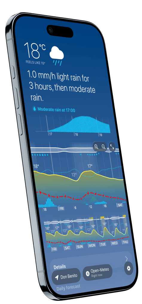
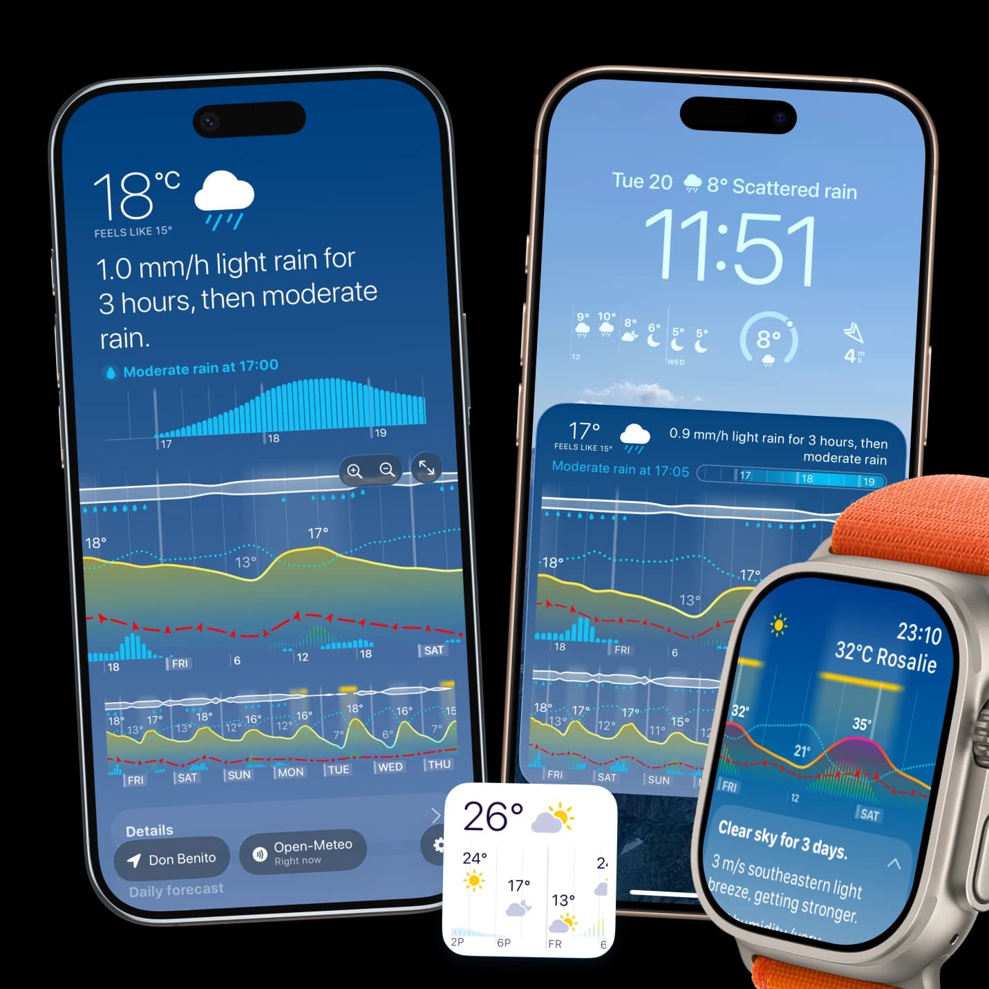
Weathergraph shows temperature and dew point as separate lines on the same hourly graph. Overnight, you can watch the temperature curve descend toward the dew point curve. When the two converge, the air is saturating—the condition fog needs.
The app does not predict fog as such, and no single pair of numbers can. Terrain, soil moisture, wind and the depth of the cooling layer all matter, and dedicated fog forecasting is genuinely difficult. What the graph gives you is the underlying setup, so a foggy commute stops being a surprise.
Sources and limits
- NWS glossary: radiation fog defines the mechanism described here.
- NWS on dew point versus relative humidity explains dew point as a saturation temperature.
- Fog formation depends on local terrain, soil moisture and wind that a general guide cannot account for. For driving conditions and travel decisions, check current observations and official warnings for your area.
Weathergraph
Watch the temperature fall toward the dew point
Weathergraph draws temperature and dew point on the same hourly timeline, so you can see the two lines converge overnight—the setup that often means fog by morning.
